
Week 11: Bolivia and The Road of Death
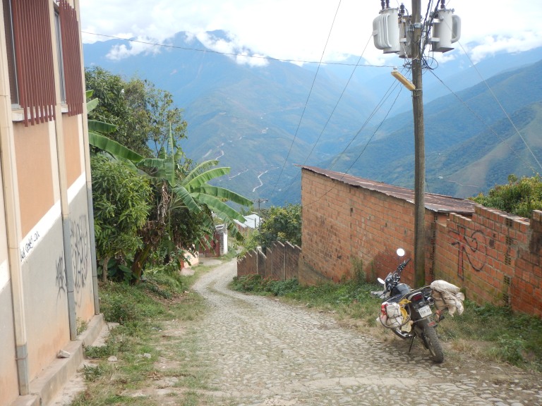
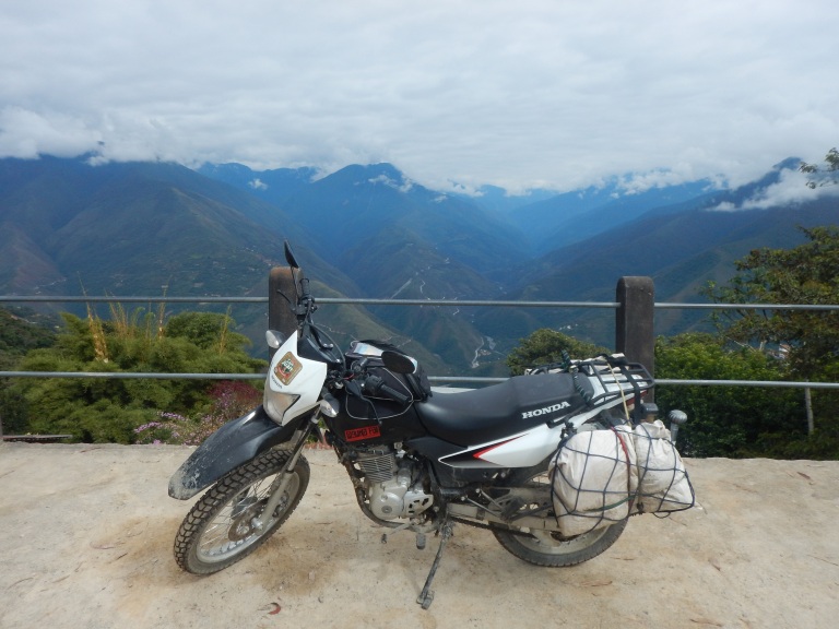
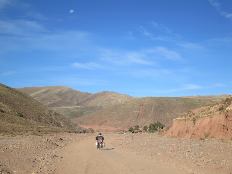
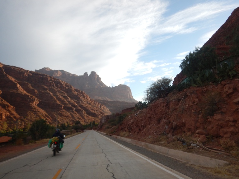
The tarmac passed beneath our feet as we weaved our way through the tumultuous traffic to find our route up and out of La Paz. Then Kenny’s rear brake began to stick again. Riding with a dysfunctional brake is stupid enough, but throw perhaps the world’s most dangerous road into the mix too and you’re just asking for trouble! We made a detour back to the mechanics where we got the bikes serviced the previous day. Kenny’s rear wheel was removed and his brake drum dismantled for inspection and a thorough clean. Before long we were back moving between traffic on the correct road out of La Paz, heading north towards a town called Coroico in Bolivia’s Yungas region.
We didn’t get Kenny or Xena’s carburettors optimised for the thin air associated with altitude as this was to be the last serious ascent for a long while. After Coroico it was to be pretty flat riding all the way to the continent’s eastern Atlantic coast, so they were probably better off tuned for sea-level riding instead. By this point though I did wish I’d just taught myself how to fiddle with air/fuel mixtures. It would’ve come in handy often.
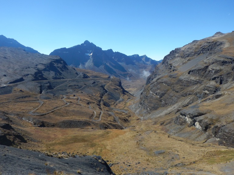
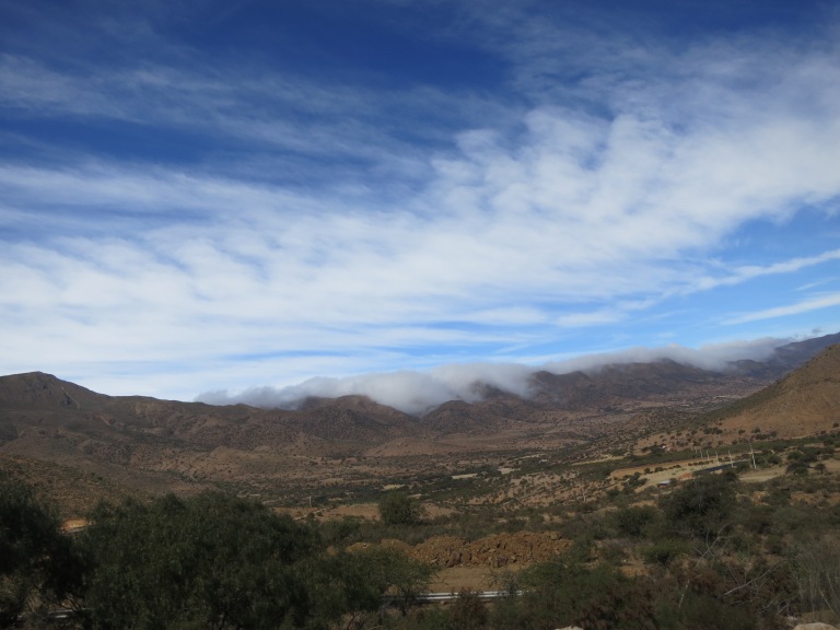
The bikes struggled considerably with the ever increasing altitude but they soldiered on, pushing us higher and higher; their hard work soon rewarded (us) with a mesmerizingly unearthly view of a ~5000 metres high valley-scape perched above the clouds. Now the rest of the day’s riding was all downhill…!
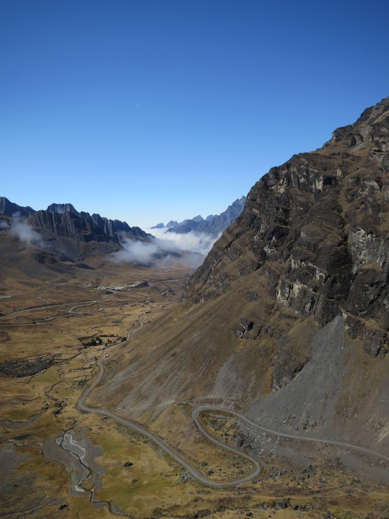
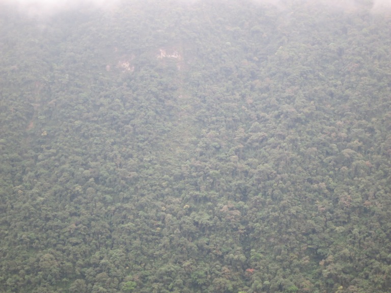
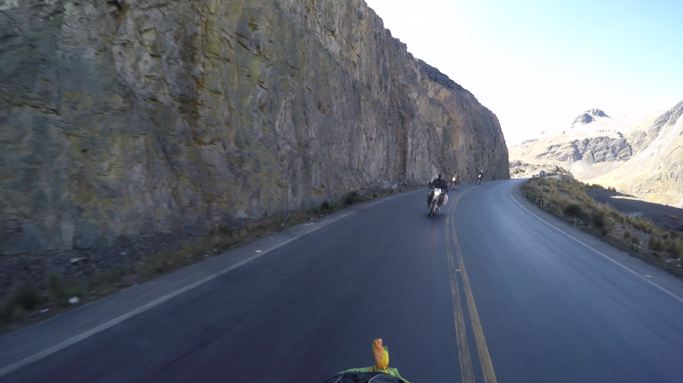
We rode down into the clouds as a bird of prey soared above. The clouds thickened. After a few more kilometres the visibility was reduced to less than 50 metres. Fortunately, we didn’t have to concentrate on the road surface too much as it was silky smooth; it had been recently built as part of a big investment by Bolivia’s first native president, Evo Morales, in an attempt to provide better infrastructure links to more remote parts of the country.
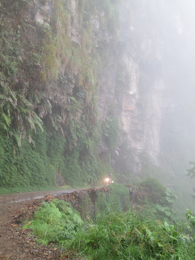
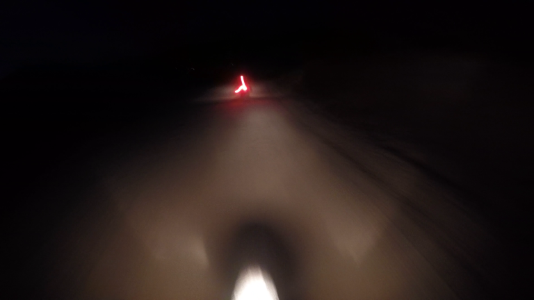
As we curved down along the mountainside in spaghetti fashion, the gradual mist settling on our visors turning into fine but constant rain droplets. We rode down, deeper into the cloud. Visibility reduced to an alarming thirty, maybe twenty metres at most. Visors required wiping every ten seconds or so, quickly just becoming smeared rather than cleared as our soggy gloves just pushed the water around instead of absorbing it. We caught up with a 4×4, presumably driven by a knowledgeable local. We opted to follow behind, using the red taillights to provide extra vision for the road ahead, rather than risk the overtake.
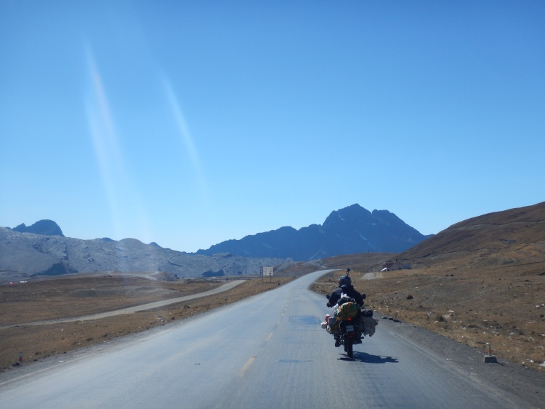
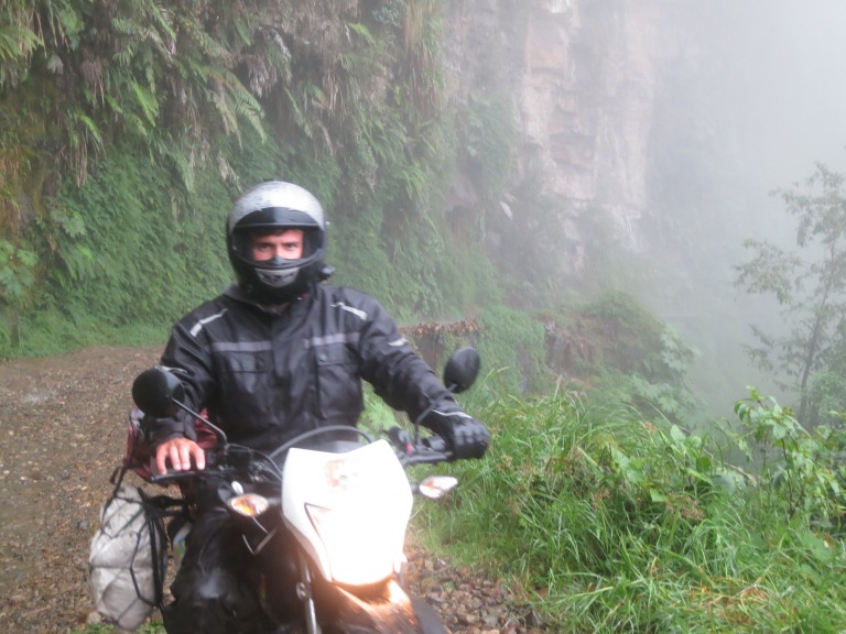
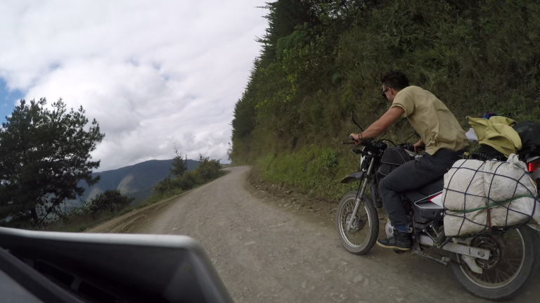
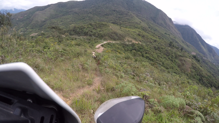
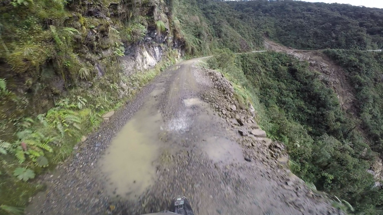
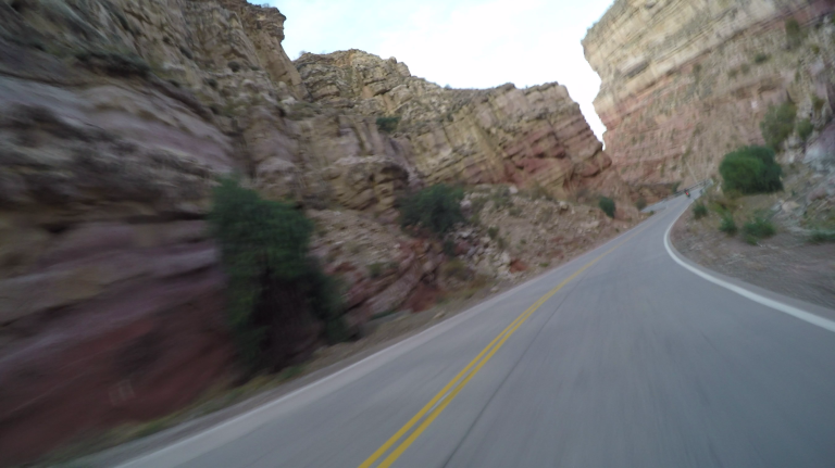
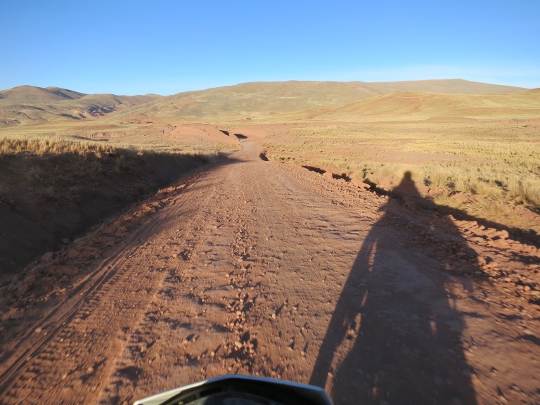
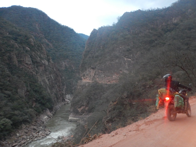
Twenty or so minutes of blind and wet riding later the rain and fog had subsided enough to provide some reasonable visibility (or, more likely, we’d ridden far enough down through the thickest part of the cloud). We reached the turn off we’d been searching for. Time to leave the sensible safety of the recently constructed longer new route to Coroico. A simple but ominous yellow sign with black capitals marked the beginning of: “DEATH ROAD”. It’s also known as the “Road of Death”, the “Road of Fate” or “Yungas Road”. Here goes.
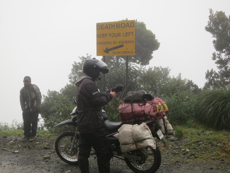
When driving or riding along the Road of Death you must actually ride on the left side of the road, rather than on the right like in the rest of the country. This is to give drivers the ability to look out of their window and clearly see how close their wheel is to the edge when inching past another vehicle. It also forces the faster downhill vehicle closer to the edge, which will ultimately slow them down when eeking past another vehicle. Wikipedia cites one source which states that 200-300 people were killed yearly along the road, although I certainly do question that source’s accuracy.
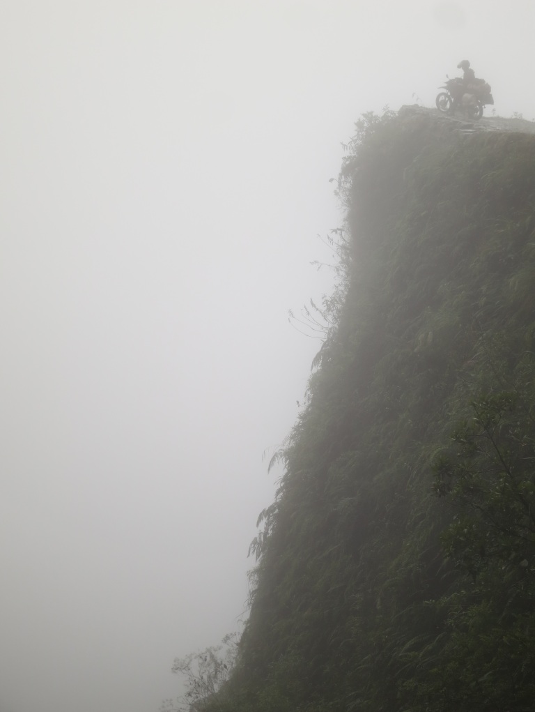
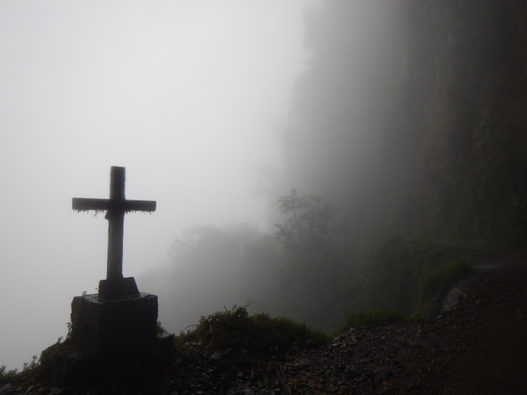
The beginning of the road is the most ridiculous part of it. At about 4500m high, the sheer drops off to the left are up to 600m high. That’s the height of two London Shards…
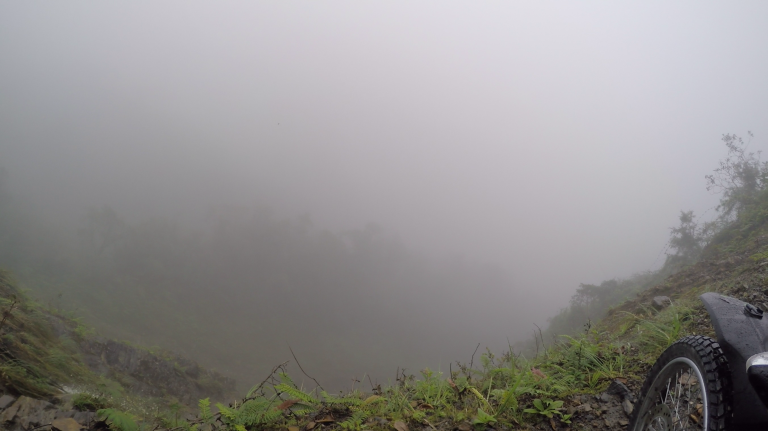
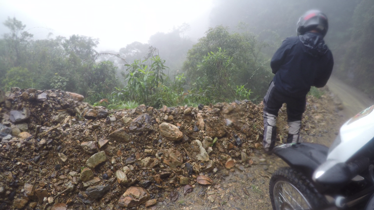
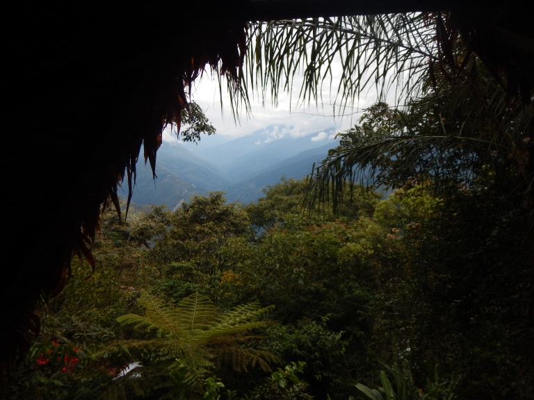
We couldn’t see the floor of to the left, nor could we see the sky up to the right. Only forwards or backwards. It was captivating, and made all the more enchanting by the eerie fog that loomed all around. We were in our own world, cautiously proceeding whilst oogling at the lunacy of this road’s existence. The somewhat spell-like atmosphere was often jolted by the numerous crosses reminding us of the hundreds of people who have lost their lives off of the edge of this short stretch of road.
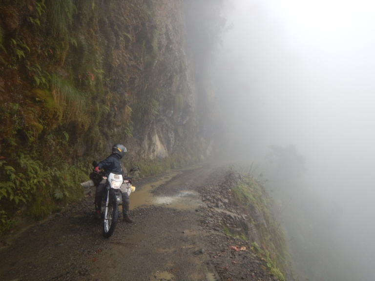
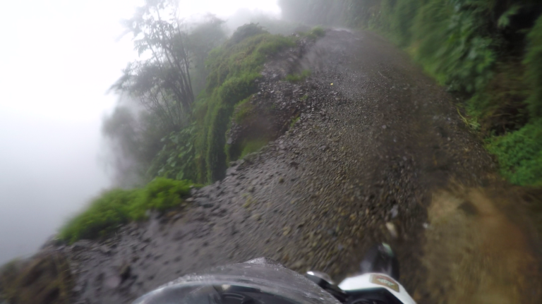
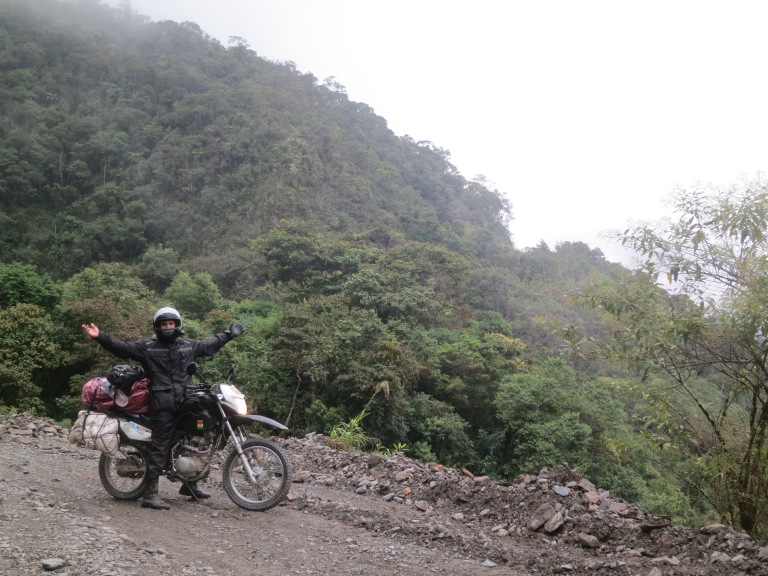
The road is etched into the mountainside. Usually it’s the width of one vehicle, but there are many passing places where two vehicles can just about get past one another. Mini waterfalls fall from above, across the road, then off into the abyss below. The road mainly had a jagged edge from previous collapses. Basic knowledge of soil mechanics from my previous job knocked around inside my head as we continued along the saturated road surface in a region where earthquakes are certainly not unheard of.
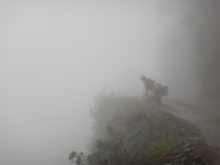
We met and briefly chatted to a lone biker, passed a couple of 4x4s and trucks and also bumped into a Norwegian bloke; he had hired a photographer (?!) and had been waiting for the fog to clear for hours at the steepest section just to get a picture! The road was about 70 km long. We steered our steeds from ~4500m, rarely more than a few metres from the edge to descend into the jungle at ~1200m to arrive in Coroico, our destination.
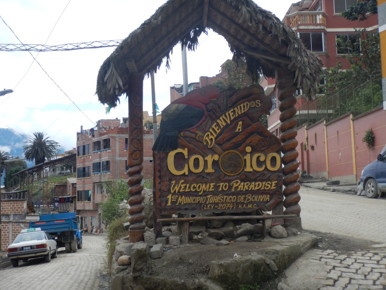
‘Welcome to Paradise’ the sign at Coroico beckoned boldly. The main plaza was a few hundred metres farther along the cobbled streets, past shops and colourful goings-on. A well-earnt bite to eat was almost interrupted by a dodgy looking policeman. He strutted out of the station and over to our bikes, luckily just as we’d finished eating, to have a nose at the bikes. He had a slimy aura about him. He stood nattering away to Raph in Spanish briefly, I deliberately didn’t get involved in the conversation to try speed things up. Then he leant on Xena. This is a no-no. You can’t just waltz over and assume that you have permission to lean on another man’s motorbike as if it were your own. Sure, touch and look, but don’t lean. Anyway, before long he’d got bored and didn’t ask to see any paperwork. More importantly his exit made Xena feel better as she was no longer being harassed.
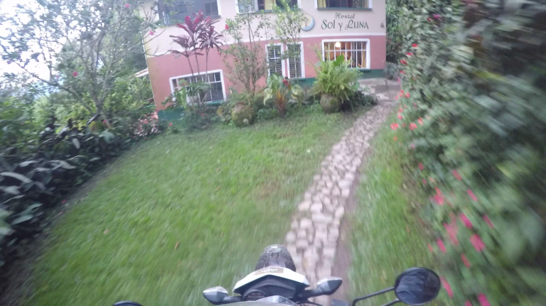
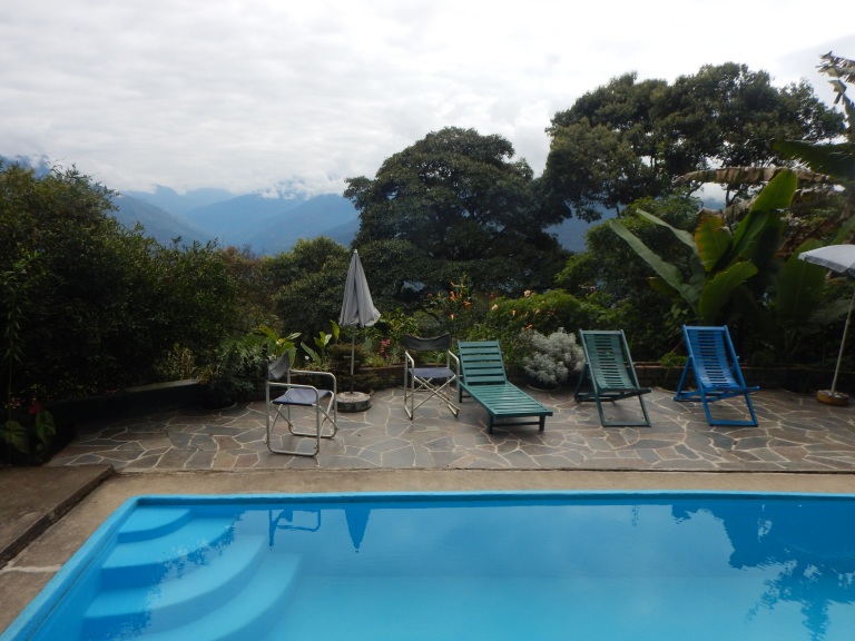
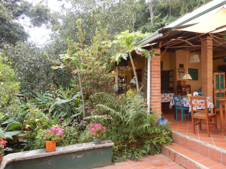
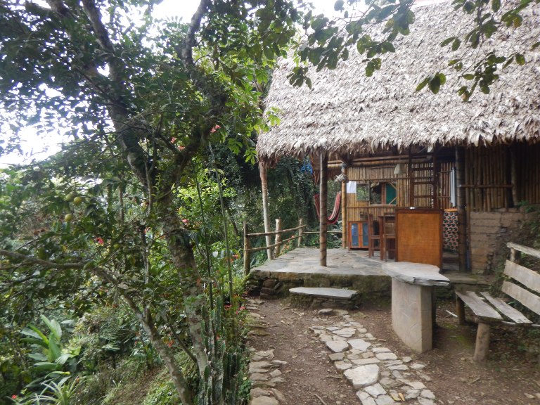
Whilst eating we had peeked at our Lonely Planet PDF to see if anywhere recommended to stay looked particularly good. We chose to ride slightly out of town down a muddy track. The jungle grew thicker and richer. The Hostal Sol y Luna was almost empty at this time of year, the only other customers being three or four older wanderers that were staying there. The beds were comfy, the showers were warm, the small kitchen and menu looked promising and there were a couple of hammocks to chill in with a good view surrounded by vibrant plantlife. Pretty impressive.
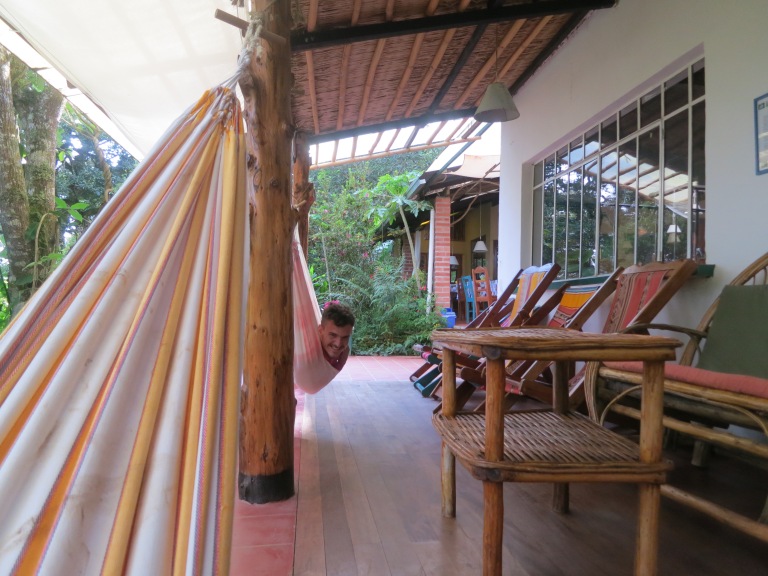
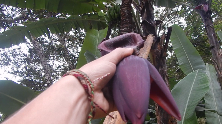
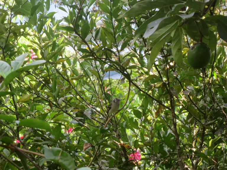
We dumped our stuff in the room and went for a mooch around the grounds. A pool! Flowers as big as your face, plantlife as colourful as an epileptic chameleon, A3-sized leaves. A small footpath skewed upwards into the steep hillside above and behind the hostal, each few minutes of walking revealing small exotic garden areas. Another minute of walking and there’s a handbuilt lodge between the trees: a prime spot to gorge your eyes on the valley vista below. More walking revealed more small lodges and garden areas. One spot had a tiled area which, upon closer inspection revealed a hot tub. Birds I’d never seen before scuttled between wacky plantlife, adding to the magical feel of this diverse natural haven. Butterflies choatically bashed about the warm air. Insects sung the songs of their people in the background. Had we arrived in paradise?
Breakfast from the tiny kitchen the next morning was drool-overable. We had reluctantly grown used to not eating anything particularly satisfying or tasty for breakfast over the past couple of months on the road. The variety of breakfast items on the menu was stupendously exciting.
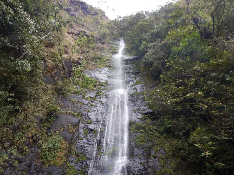
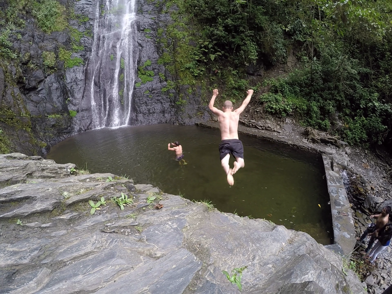
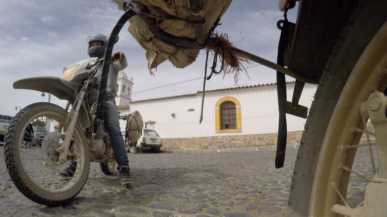
Stomachs and minds contented, we headed out on light and nimble bikes to see what was around. We knew there were waterfalls and natural pools to swim in nearby so we wore trunks and strapped towels to the bikes. We intended to ride around the circumference of a mountain next to Coroico, but the route wasn’t as straightforwards as it had initially seemed. We raced our Hondas for a bit along the quiet twisty dirt road for a bit before stopping to investigate a waterfall. We jumped in for a swim, but only for a few seconds as the water was bloody cold!
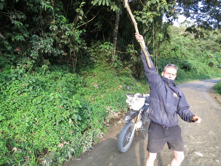
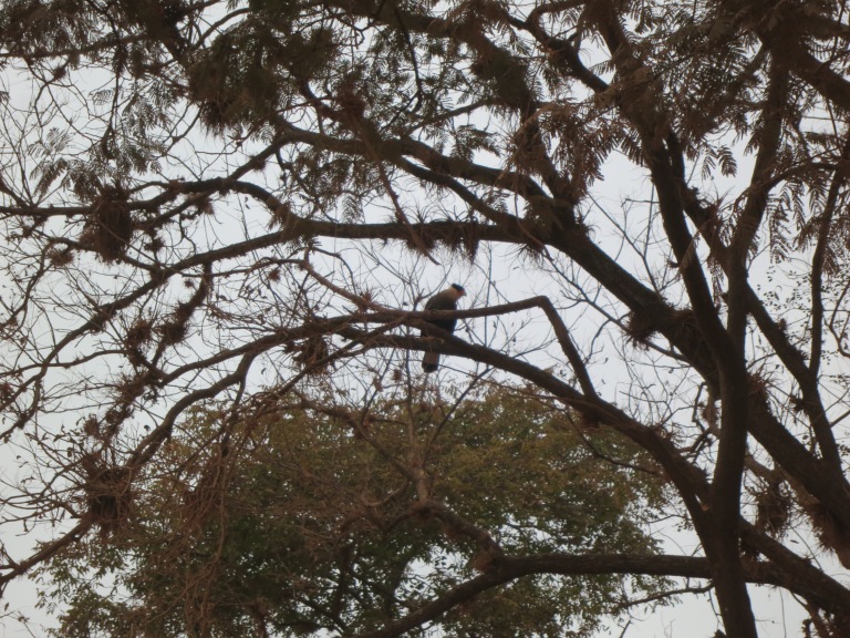
We cruised on for a couple of hours, passing through countless villages and alongside endless coca fields before realising that we’d gotten a bit lost. The correct route back to Coroico (in a loop rather than doubling back on ourselves) found us eventually. We stopped at one spot to take some pictures of the sprawling greenery beyond us; suddenly a flock of green birds swarmed from nearby, squawking and chirping in unison as they flew overhead and into distant trees. We continued, almost without distraction, back to Coroico, but were forced to stop and play (for lack of a more mature (read: correct) word) on a Tarzan-esque vine hanging from a tree above the road! Riding from A to A, rather than A to B was a welcome change.
The next day we truly lived like kings. We agreed that Coroico, and the Hostal Sol y Luna was one of the best places we’d stayed at and sod any rough plans we had, we would book ourselves into one of the lodges up in the hillside behind the main house.
We marvelled at the menu for breakfast. Yum. For lunch we went to another hostel, this one was owned by a French couple who liked to cook food for their menu. This hostel was also perched up high on a mountainside. It had less plantlife than where we were staying, but a more unobstructed view of the tree-coated mountain valley which extended as far as the eye could see into the distance.
Raph spoke French to the owner who had emigrated to Coroico many years ago to run the hostel with her husband. They grew lots of their own food. She picked us coffee fruit directly from her coffee plant; the remarkable sweet flesh hid the unmistakable shape of a coffee bean beneath. She explained that coffee fruit is a common sweet for kids here. She lead us to a table made from an enormous slab of rock, facing out towards the valley view of yonder.
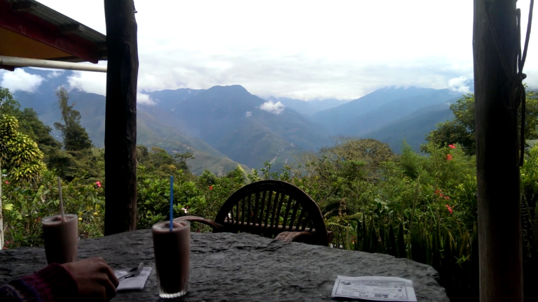
We feasted on a freshly made zingy curry and a delicate trout pasta dish whilst sipping milkshakes and listening to a masterfully curated blues playlist, overlooking the millions of trees in the distance before us. We were living like kings. Who’d’ve thought we’d be eating so well in Bolivia?
As if that wasn’t enough, we then rode back to the Hostal Sol y Luna and hopped into the hot tub we had prearranged earlier on to be ready for this time. Laguna Pai played from the mini speaker and butterflies hovered above. The icing on the cake though? The hummingbird flittering from branch to branch nearby. Bliss. Coroico had lived up to its signpost: it was nothing short of paradise.
That evening we rode into the plaza to watch Boliva vs Peru in Copa America. Bolivia lost, but we were neutral in this game. We were routing for Chile ultimately! At night we returned to the mini lodge to lounge about and rest in hammocks and take everything in…. just generally doing very little!
We had learnt that we would have to ride back up the Road of Death, back through La Paz to continue. The route we had originally intended to take didn’t really exist or would take three days according to the couple of locals that we asked. They all suggested doubling back via La Paz as the best option. It’s also worth noting that in Bolivia and Peru distance is often discussed in hours or days rather than in kilometres.
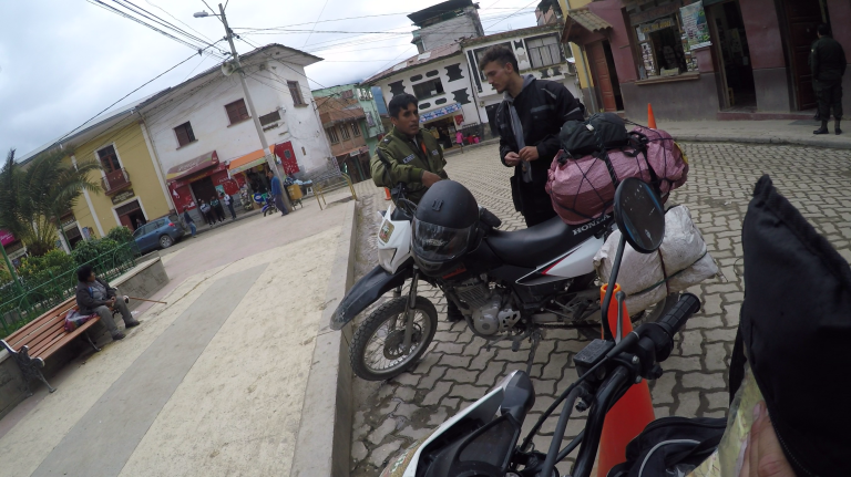
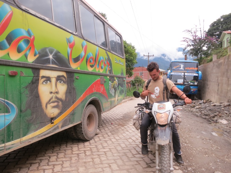
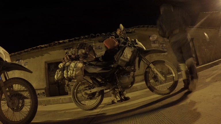
The next morning, on Saturday the 27th of June, I headed into the main plaza to get some cash out. I spotted a couple of gringos on bikes! We chatted quickly in English (as they were Dutch) and realised we were both heading along the Road of Death that morning and we should ride together as a four. They agreed to wait in the plaza for 30 minutes while I rushed back, informed Raph, ate breakfast and packed.
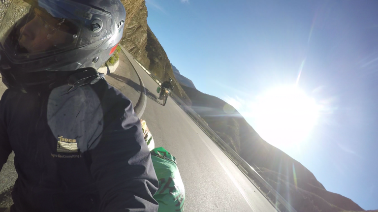
Half an hour was ambitious in hindsight. 35 minutes later we rolled into the main plaza to find a distinct lack of Dutchmen on motorbikes. We must’ve just missed them. Perhaps we’d catch up with them. Somehow Raph and I managed to lose each other for a while, but before long we had regrouped and quenched Kenny and Xena’s thirst with 24 litres of explosive motorbike drink. We punched the bikes into gear and pelted off towards the Road of Death in an attempt to catch up with the Dutchmen.
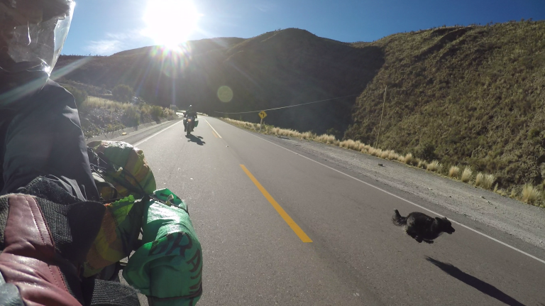
We nearly had a head on collision with a local guy on a bike: what was he doing on the left hand side of the road!? Quick reactions from all parties involved reduced the incident to a mere near miss. Ah yeah, this is the Road of Death, we should be on the left side, not the right. Ooops.
More fast riding uphill brought us to a checkpoint. The other day this had been unmanned and we just rode straight through. This time we had to pay some Bolivianos to use the road. We mingled momentarily with two South African dudes with had just come down the road on big rented BMWs. They informed us that the Dutch father and son weren’t too far ahead, we could probably catch up with them before the end of the Road of Death.
I had been reluctant to tell anyone at home about the road before riding it, but had messaged my sister a couple of days ago once we had successfully arrived in Coroico. Her reply of all possible replies? “Just don’t do it again”. So here we were, riding it again, properly shifting this time though, hooting at every corner to alert whatever lurked ahead, eagerly trying to make up lost ground to catch up with two Dutch guys.
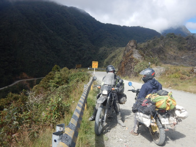
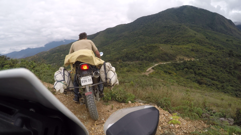
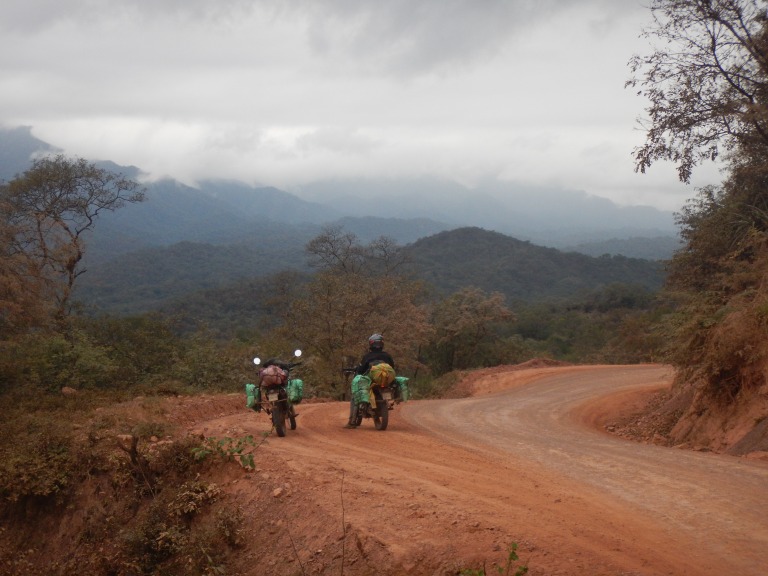
Maybe twenty minutes later and we had them in our sights. A cursory apology for being late was followed with greetings, chat and then motion. Our eight-wheeled Honda-powered convoy moved up the Road of Death with gusto. The scenery was vast, there were no clouds this time. The Dutch son had ridden from Buenos Aires to Peru, to meet his Dad for the Peruvian leg of his journey. We powered on, avoiding the occasional pack of cyclists coming downhill. We came across the same few wooden structures that we’d seen at the start of the road a few days ago. Hang on? We’d already finished the road? That was worryingly faster than expected!
Bewildered at how short the ascent was, we continued back towards La Paz, climbing the new road which had been engulfed by clouds a few days earlier. Kenny and Xena struggled compared to their 250cc Honda Tornado cousins ridden by the Dutchmen. They kindly stayed with us at our pace, soon returning to normal pace as we peaked the ascent and gravity joined our side. We rode into the outskirts of La Paz and onto a busy triple-laned motorway where we pulled over to the side, said goodbye and goodluck, and parted ways.
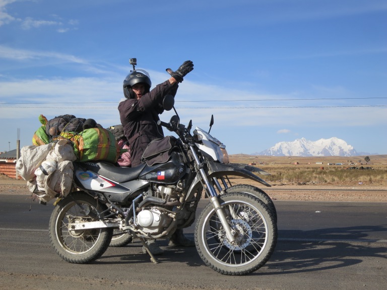
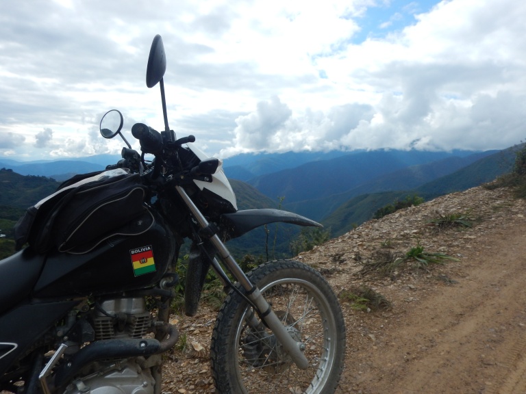
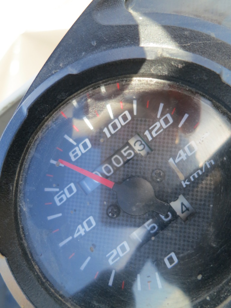
Raph and I veered off south towards Oruro, a fairly nondescript mining town. We rode at considerable altitude across the altiplano for most of the afternoon. The landscape was harsh and quite barren. A snow-capped peak could always be seen somewhere on the horizon. Kenny and Xena hit the 10,000 km mark! So much abuse and load that they are not designed for, yet so little trouble. Troopers! We reached Oruro not too long after the earth rotated enough again to replace sunlight with the blackness of space. We found a place to sleep, our Chilean bikes comfortably resting next to a Colombian bike in a spare room of the hotel.
That night we ventured to a top floor German themed beer bar. We had to use a lift. Come to think of it we probably hadn’t been up so many stories since Santiago. On the way into Oruro we’d ridden past a nightclub/party. After some beers we went in search of said party, only to find it was a private wedding that had finished anyway. Oruro was cold and not very lively, or if it was, we certainly didn’t have the desire or knowledge to find it! Time for sleep.
Sucre was our target for the end of the next day. We left Oruro, eating a traditional lentil/soupy breakfast with old ladies in a market on the way out of town, and began to clock up the miles. We joked about going to the salt flats in Uyuni again as they were actually only ~200 km south west of our location.
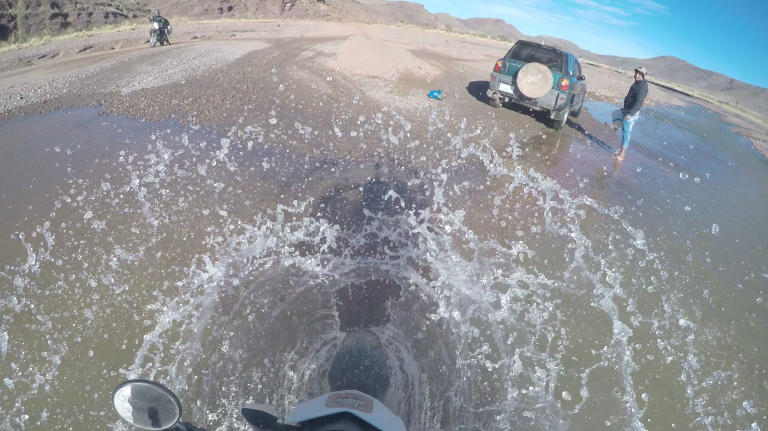
The road was decent to begin with but by the afternoon we were riding on some fun twisty dirt. A cloudy small river blocked our path, but it turned out to be far less intimidating than we initially thought and was no match whatsoever for our noble steeds. The dirt roads continued. Night fell. The dirt roads continued. Night stayed. We thought we were about an hour from Sucre, only to be informed by a local that we were nearer to three hours away.
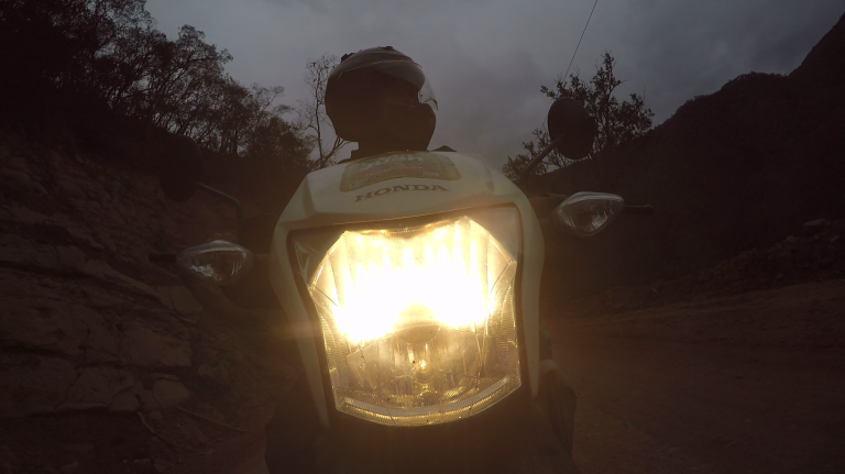
I’d love to be able to describe the scenery but all we could see with Kenny and Xena’s headlights was an endlessly changing patch of fast-approaching dirt on the floor a few metres ahead. We rode the dirt for another hour or two before needing to refuel from the jerry cans. The road became tarmac again as we presumably approached Sucre. We carved this tarmac up for another hour until the relieving city glow of Sucre greeted us on the horizon. Time to eat.
Most places were shut as it was at least 22:00pm. We found one place on the main plaza that was still open though. It was pretty swish: we got a seat on a balcony overlooking the street below. We people-watched as we munched and sipped a beer. Kenny and Xena were always the centre of attention with their unfamiliar Chilean numberplates and burgeoning loads.
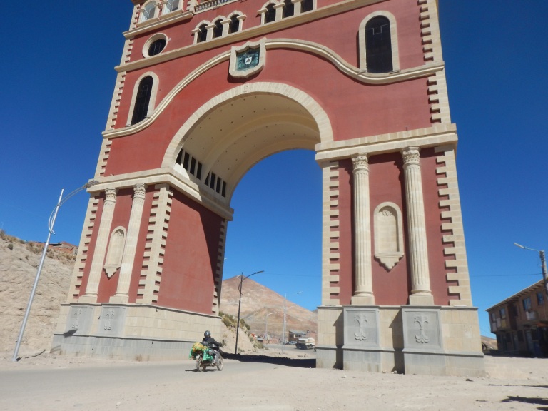
Sucre is a UNESCO world heritage site and the constitutional capital of Bolivia. It was founded in 1538. Its decidedly Spanish architecture sits at a cool 2800m above sea-level. It’s also twinned with Cardiff, which is a completely irrelevant fact.
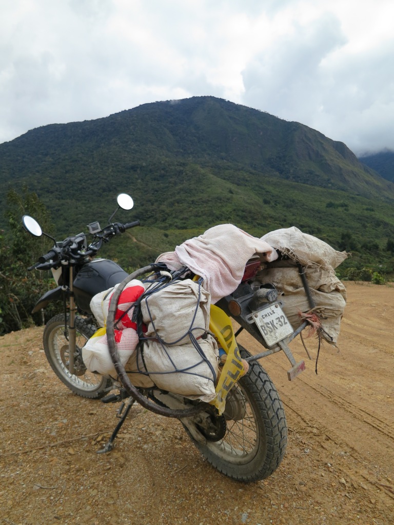
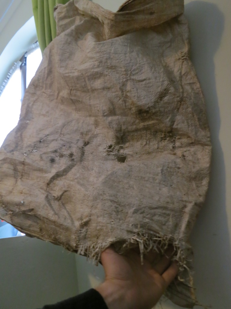
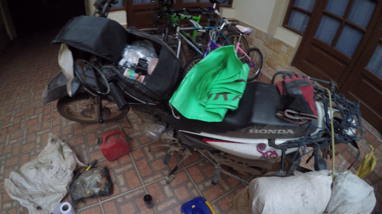
We stayed in Sucre for two nights at a friendly hostel in the centre of town which felt more like a meticulously cleaned home than a place that hosted weary wanderers. We did a bit of bike maintenance and bought some new green rubble backs to replace the battered old white ones. We’d lost a gas canister and who knows what else through the torn white bags. I found a plastic container to serve as a new toolbox. It was cracked and disfigured within a few days of riding (dropping)…
We watched Copa America in a bar nearby with a French guy from the hostel one evening. The bar also did a Full English breakfast, so that craving was satisfied in the same bar the next morning.
The Dad of the family who ran the hostel enquired about our trip and next destination. He invited us into their private house and kindly pointed out the best route for us to take to Tarija. He pulled out a large poster map of Bolivia and compared it to the route on the MAPS.ME app on Raph’s phone. He suggested a route which was longer in distance, but informed us that the roads MAPS.ME were awful and would actually take longer.
Armed with our new route knowledge to Tarija via Potosi we hit the road the next morning. The excitement of firing up my bike every morning for the typical ten to twelve hour ride still wasn’t showing any sign of fading. By lunch we reached Potosi.
Potosi is plonked next to the world’s largest silver deposit up at 4090m above sea-level, making it one of the highest cities in the world. The city is almost as old as Sucre, dating back to 1545. Its population rapidly grew in size to about 200,000; the silver mine being the catalyst for such growth. The Cerro Rico de Potosi (the silver deposit mountain) effectively single-handedly funded the New World Spanish Empire according to some sources.
Lunch found its way into our stomachs. We left Potosi, rode past and around the Cerro Rico and onwards to the undulating but gradually downwards roads ahead. As we rode I noted how the oil marks on the roads differed: the uphill side of the road would always have a wide, consistently present black smattering of oil that had escaped from engines/gearboxes/driveshafts under the increased pressures involved with driving uphill. The downhill side of the road on the other hand would always be clean with the exception of the odd few drips of oil as vehicles glided along effortlessly with the help of gravity.
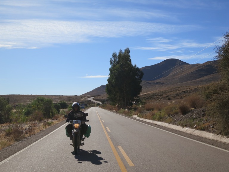
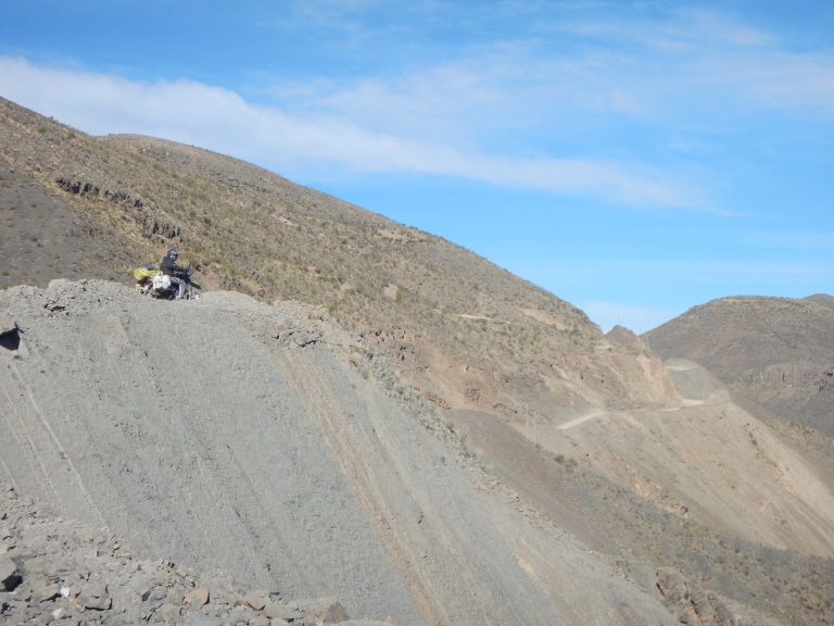
We cruised on, directly south down Bolivia’s Ruta 1. The terrain changed to a rich deep red colour. Out of nowhere, rock formations appeared which can easily be described by simply likening them to the Grand Canyon. The reassuringly relaxing and empty asphalt snaked alongside these stunning rock formations for an hour or two before we headed east towards Tarija.
The rich red rock became intermittently dissected with a freakishly yellow rock. One slab red, one slab yellow. More twists and turns, and tens of kilometres, and the yellow rock encompassed and replaced the red rock, signalling our exit from the unexpected additional visual feast of Bolivia’s own Grand Canyon.
This new, more regularly changing scenery also indicated that we had crossed Bolivia’s altiplano and were now heading towards Paraguay on the eastern border and into the flatlands of the centre of the continent.
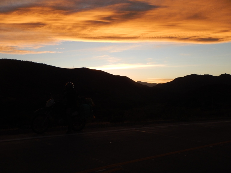
The clouds behind us mutated into a sanity-questioningly yellow hue, a colour that I had never before seen our sun set even close to. Our cameras did a reasonable job of capturing the colour, but in reality it was more yellow than orange.
The last one hundred kilometres or so of hairpin after hairpin was fairly cold. Not spine-numbingly cold, but certainly capable of numbing fingers.
Tarija’s traffic was out in full force. We were cold and hungry, so we flicked the ‘filter like twats’ switch firmly to the ‘ON’ position and blitzed into the main plaza far faster than standard traffic regulations would have allowed for.
A bar/restaurant glistened from the corner of the main plaza. Copa America was on inside. We parked Kenny and Xena on the pavement outside. We ate and drank. Then we got robbed. Some thirsty thief stole our bottle of water that had been strapped to Xena. We conceded that we’d had an astonishingly small amount of trouble crime-wise throughout the whole trip so far, especially considering how much the bikes had been left unattended and fully loaded.
I managed to drop my decent genuine-brand camera battery down a tiny uncovered drain beneath Kenny. A quick peek with the torch revealed the battery innocently sat at the bottom, on top of all the rubbish at the base of the luckily-dry drain. With at least ten people watching as they waited in traffic behind, I concluded that it was indeed worth getting down on the ground and sticking my whole arm in the drain. It was a waste of time, I’m only little and couldn’t reach. Fortunately, there was a piece of plastic piping in the drain. I attached some gorilla tape in a double-sided fashion to the end of the piping and managed to fish the battery out by sticking it to the tape on the end…whilst taking great care not to drop the torch in either. Result.
After the football we had to traipse around Tarija asking at about ten different places before we found a reasonable place with beds available and parking for Kenny and Xena. We went back out into Tarija after.
We nailed a solid breakkie the next morning which fueled us nicely for our ride to Villamontes the next day. In terms of distance it wasn’t very far to Villamontes but the roads weren’t tarmacked, making for attentive and inevitably slow progress. We headed east. A small mountain range braced the horizon ahead. Clouds hovered above it: Bolivia’s Table Mountain perhaps?
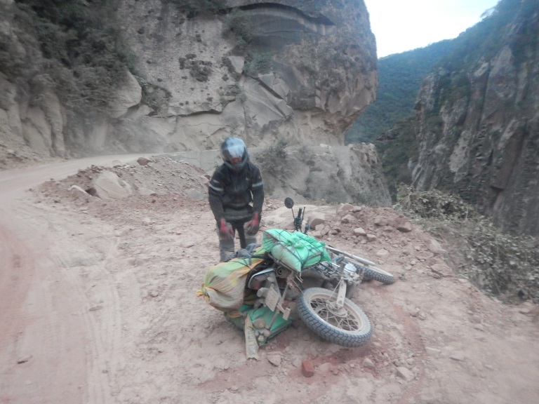
I had a wobbly that sent swathes of adrenaline pumping to every corner of my body. The dirt was ever-present and plentiful but evenly spread, the road was downhill and devoid of any other cars, the throttle was open, my smile grew childishly inside my helmet, I opened the throttle more, my heart pumped and grin enlarged. Then I read a corner wrong and couldn’t help but go off-centre, ploughing the front wheel into an unfortunately deep sandy section. The front began to slide beneath me. I over-corrected. It began to slide the other way. I over-corrected. Somehow I managed to stay upright, fish-tailing along whilst firmly applying the rear brake until everything was back under control. I jumped off Kenny to take a cheeky breather. I felt full of life, undeservedly and ironically so.
The scenery became greener, even jungly at points (but a drier kind of jungle), as we pursued onwards towards Villamontes, the last Bolivian town before Paraguay. New birds could be seen enriching the surrounding landscape through our scuffed and scratched visors. We passed a few drilling sites. The abundant carbon-based life above ground here must equate to rich hydrocarbons beneath.
One section of the road was carved out of a cliff much like the Road of Death. I ventured near the edge. I’d been struggling to get Kenny’s idle speed correct for a while. His engine cut out due to lack of revs on my part. I released the clutch and took some pictures. Upon restarting his engine, we lurched forwards coming to a stop far, far too close to the massive lack of floor beyond. I had started him in gear without using the clutch. Had he been a bigger bike there would’ve been a bigger lurch forward, and probably a different end to this story.
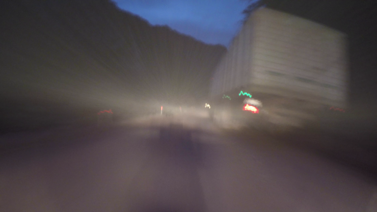
Darkness fell and the number of cars travelling along the slim dirt road increased drastically as we neared Villamontes. The extra traffic kicked up lots of dust making visibility pretty poor, but oncoming headlights are difficult to miss at night so it wasn’t a big issue but did require extra attention.
We got to Villamontes and ventured around without consulting the MAPS.ME app. We soon stumbled across an unexpectedly large hotel that even had a car drop-off valet area outside the main doors. Numerous clocks behind the counter displayed the current time around the globe whilst the receptionist informed me that the price was ~£100 per night! Erm “gracias, pero no gracias”. This hotel must’ve been used exclusively by visiting oil and gas professionals.
MAPS.ME informed us that we were actually out of town a bit. With our headsets switched on we nattered as we blasted around Villamontes, finding a suitable place to stay on the fourth or fifth attempt. By now we were fairly efficient at scouting out places to stay using the same, comically-pronounced phrases and questions for each hotel we enquired at.
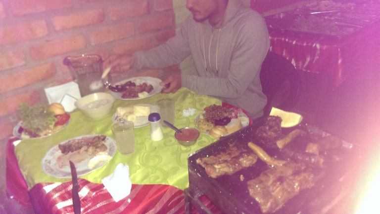
We gorged on a beef feast that night in a small restaurant full of locals. Our journey had now brought us to the flatter lands of the continent; cattle-farming was more common here. Small free-standing BBQ hot plates were positioned next to each set of plastic tables and chairs. A nearby table offered a selection of crunchy fresh salad. The BBQ sizzled and popped: sausages, steak, kidney, liver,… and a few other difficult-to-identify anatomical parts. It was delicious, but I won’t be in any rush to source the particularly memorable tubular, rubbery thing we had. An oesophagus perhaps?! One day I want to try and recreate the satisfying starter dish, which was, well, just cheesy rice pudding!
The next morning we discovered the huge local covered market and its food section. Breakfast was rather naff, but we did managed to find a couple of good gifts for family back at home from the other market stalls. I also bought four cans of spray paint to spray the panniers and bike rims jazzy colours. It was obviously a stupid purchase: I ended up losing two through a hole in the rubble sack later on, and never even using the other two, merely transported them thousands of miles till the end of the trip…!
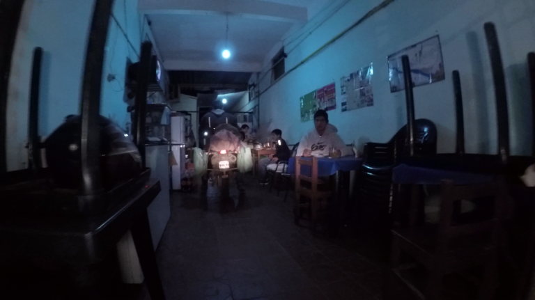
We were leaving Bolivia into the empty grassy woodlands of Paraguay’s western Chaco region. We’d be camping one or perhaps two nights, so we stocked up on water and a bit of food in Villamontes. Next, we packed up Kenny and Xena, rode through the corridor of the hotel (which was also a kitchen and living area too) and hunted our way out of town east towards Paraguay. Soon we had a well-tarmacked, dead-flat and dead-straight road with wild shrubs over-growing into the road from both sides. The scenery was a remarkably simple and consistent here, a stark contrast to the rest of the country. Bolivia has the most extreme and other-worldly scenery I have ever laid my lucky eyes upon; it’s astonishing when you think that such varied natural landscapes are contained within a single country’s borders.

I want to stay in Hostal Sol y Luna! Brilliantly written update Joel, I’m just glad I didn’t know about Death Road at the time xxxxx
LikeLike